EUMETSAT Satellites Set to Sharpen Africa’s Weather Forecasting Tools
WINDHOEK —Africa’s capacity to respond to extreme weather and climate shifts is set to improve, following new satellite support from the European Organisation for the Exploitation of Meteorological Satellites (EUMETSAT). The third-generation satellites will help countries across the continent receive more accurate and timely weather data, enabling faster responses to emergencies and better planning.

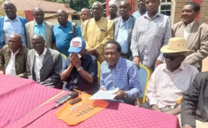
Speaking at the Joint ClimSA and SEWA Forum in Windhoek, Namibia, stakeholders emphasized that the Space for Early Warning in Africa (SEWA) program will depend heavily on EUMETSAT’s satellite data to improve real-time weather forecasting and climate monitoring across the continent.
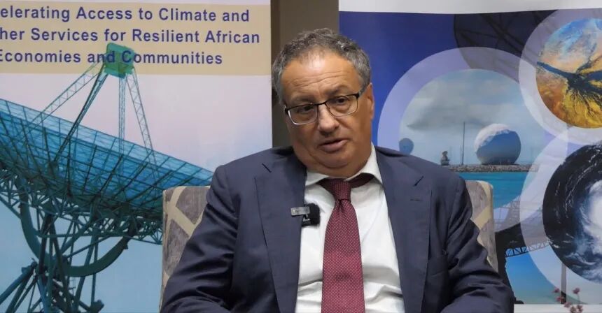
EUMETSAT transmits weather and climate data directly to national meteorological services. The satellites play a critical role in detecting climate patterns and issuing alerts before disasters strike. “We help in the retransmission of the data,” said Vincent Gabaglio, who oversees EUMETSAT’s international relations. “Countries along the River Nile, for instance, sometimes face difficulty receiving timely information, so we use satellites to bridge that gap.”
Gabaglio added that EUMETSAT will train African meteorologists to interpret and apply satellite data more effectively. One of the main training centers will be located at the Institute for Meteorological Training and Research (IMTR) in Dagoretti Corner, Nairobi. The center is expected to play a vital role in preparing Africa’s weather experts to respond to increasing climate-related threats.
“We need to train a critical mass of people, because it is new technology and forecasters need to be trained adequately,” Gabaglio said.
A Push for Climate-Resilient Agriculture and Urban Planning

Ottavio Novelli, who leads climate-related programs at Agriconsulting Europe S.A. (AESA), stressed that building climate resilience is key to achieving sustainable development. “Africa needs to adopt farming practices that consume less water but increase yields,” Novelli said during the launch of SEWA.
He pointed out that large African cities such as Accra, Lagos, Dakar, Dar es Salaam, and Nairobi are increasingly vulnerable to climate disruptions. “Africa must organize itself through south-south cooperation and work closely with European countries also affected by climate change,” he said. Novelli urged African nations to learn from scientific research to better manage rapid urbanization and resource demands.
Novelli also called for the use of climate data tools to guide policy and budget decisions, highlighting that clear, science-backed planning helps governments focus resources where they are needed most.
Building on the Abidjan Declaration
The 2018 Abidjan Declaration laid the foundation for Africa’s expanded use of the Meteosat Third Generation (MTG) system. The agreement called for strengthening the continent’s ability to apply satellite data in day-to-day weather forecasting, disaster risk reduction, and long-term climate planning.
Through SEWA, EUMETSAT and African institutions aim to:
- Expand access to Earth Observation (EO) data across the continent
- Build technical skills and knowledge-sharing networks
- Improve institutional coordination for early warning systems
- Establish the African Meteorological Satellite Application Facility (AMSAF)
SEWA’s goal is to ensure that meteorological data reaches the right people from local farmers to national disaster agencies in time to act.
Africa’s future climate resilience, experts agree, will depend on combining cutting-edge satellite systems, strong regional cooperation, and community-level preparedness. With EUMETSAT satellites now in orbit and training initiatives underway, the tools are finally aligning to make early warning systems a reality for millions.